About me
Introduction
My research focuses on remote sensing greenhouse gas measurements, especially anthropogenic emissions of carbon dioxide and methane. Currently, I am part of the MethaneSAT science team at Harvard University. The satellite mission objective is to quantify over 80% of global Oil and Gas emissions - an ambitious goal for which the satellite was specifically designed. I contribute to developing the emission inversion methods for turning the satellites observations into actionable, regional scale surface fluxes, as shown on our web portal.
I received my Ph.D. from the Institute of Environmental Physics at Heidelberg University in 2024, graduating with Summa cum Laude. My studies were supervised by Prof. Dr. André Butz, who leads the research on atmospheric remote sensing. My research addresses methodological needs in our observational capabilities, like satellite validation over water surfaces or source variability and intermittency.
Past Work
I planned and executed several field campaigns during my time in Heidelberg. Thus, my research has led me around the world, from five weeks on board the RV Sonne in the Pacific Ocean to the volcano Mt. Etna in Sicily and the coal mine ventilation shafts in the Upper Silesian Coal Basin. Consequently, I work with my experimental measurements and develop or adapt state-of-the-art methods to advance our understanding of anthropogenic greenhouse gas emissions.
I pioneered ground-based carbon dioxide imaging using a hyperspectral camera at a powerplant in Mannheim. Additionally , we conducted a field campaign in Poland in 2022, where coal mining causes a significant fraction of European methane emissions. Although studied extensively in the past, methane emissions from coal mine ventilation still need to be better constrained and understood due to the complexity of the causes. We were the first to deploy an imaging spectrometer in the vicinity of a coal shaft, and I could show that it is possible to observe high-frequent emission dynamics using plume imaging. This information is crucial to understanding the meaning of snapshot images from airborne instruments. Furthermore, repeatedly taken images alone provide important information on the sources, e.g., the effective atmospheric emission height of methane for climate models.
 |
|---|
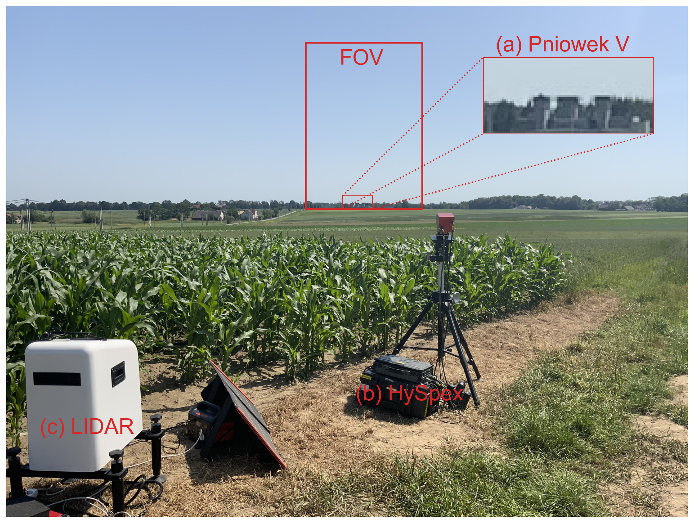
| Our field setup in Poland; we are observing coal mine ventilation shafts (a) with a hyperspectral camera (b) and a co-deployed wind lidar (c). |
 |
|---|
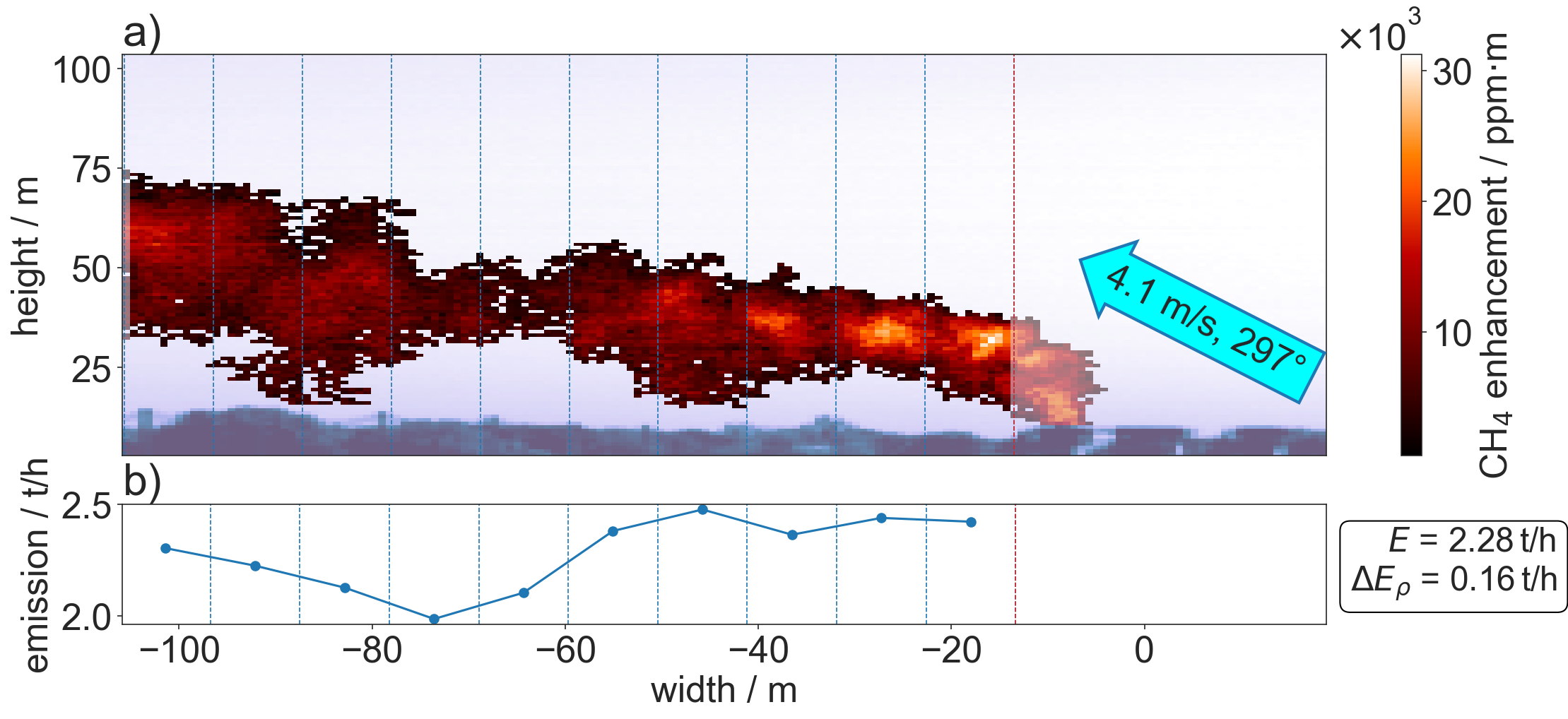
| This was one of the methane plumes I observed (a) and used for an emission estimate (b) of the coal mine ventilation shaft. |
In 2019, I spent five weeks on the German research vessel Sonne. I developed a weather-proof housing for an FTIR-spectrometer capable of measuring from a moving platform. I evaluated the data in my master’s thesis and published them as they provide rare validation opportunities for greenhouse gas observing satellites above the ocean.
 |
|---|
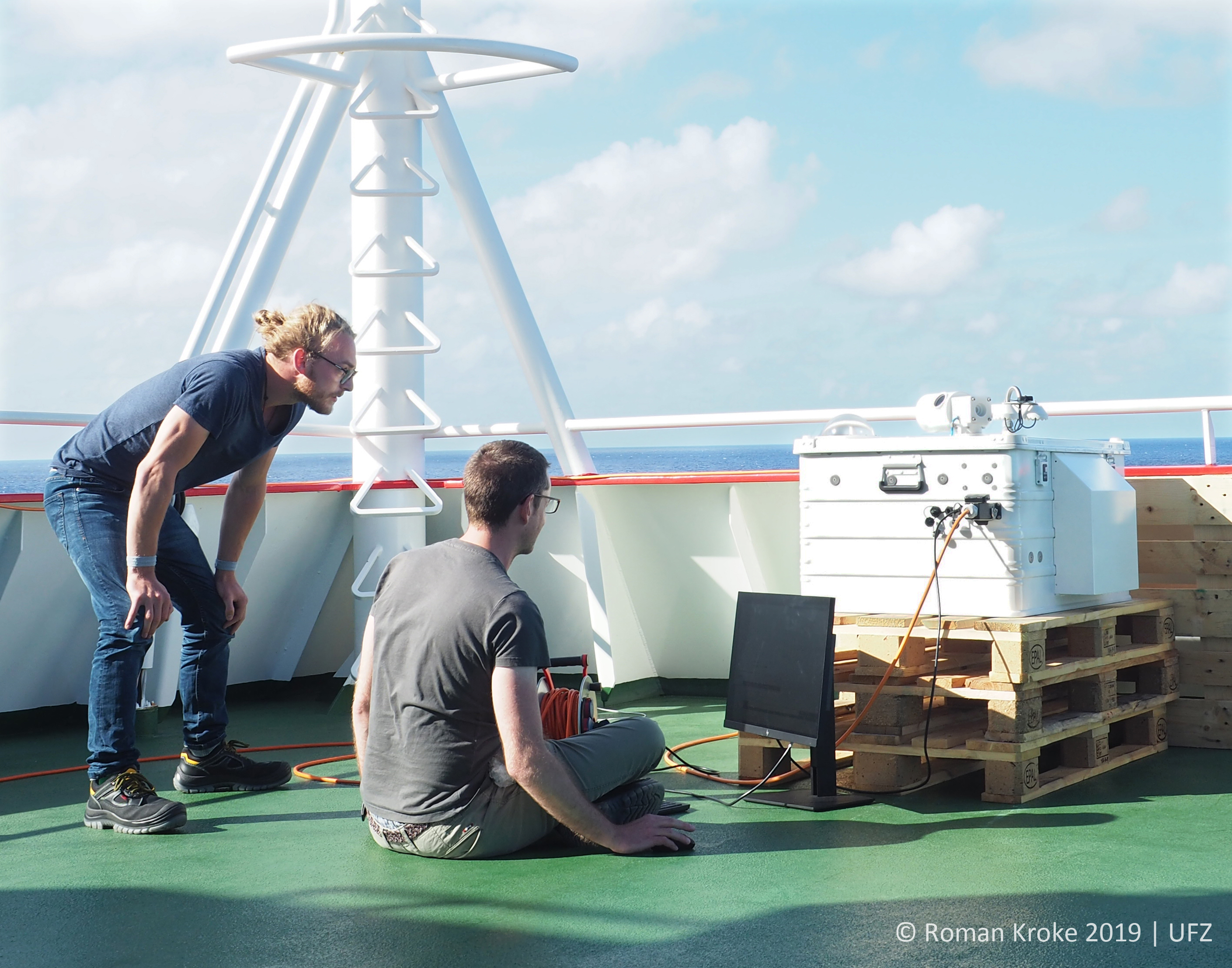
| My colleague Ralph and me are thinking pretty hard in the middle of the Pacific Ocean. |